


What we do
Earthworks and drainage
Land forming and levelling guided by accurate survey and practical drainage planning, so water runs where it should and drains away.
Overview
Water that runs off, not water that sits.
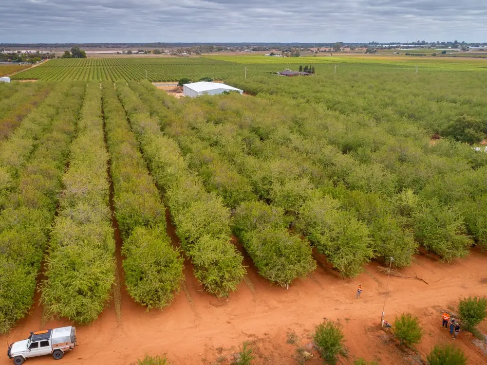
We survey, model and plan earthworks and drainage for irrigated farms, with a focus on reducing areas where water sits. On a current job, we're carrying out 2,500 ha of RTK grade survey and preparing cut and fill machine files. We're also managing laser bucket work to recut mid rows and headlands in an existing orchard and improve runoff.
Existing orchards
Mid rows and headlands recut so water runs off and drains.
New developments
Ground formed and drained before planting.
Earthworks contractors
Cut and fill volumes to price from and machine files to cut to.
What we do
What we cover.
Land forming and levelling
Land forming shapes the ground so irrigation water and rain go where you want them. We design the levelling field by field, on flat row crop ground and on sandhills.
- Field design of levelling
- Levelling for row crops where water pools
- Sandhill grooming
- Surface drains shaped into the design
Survey and cut and fill
Every design starts from an RTK grade survey of the natural surface. From it we calculate cut and fill, so the earthworks can be quoted from accurate volumes.
- RTK grade survey of the natural surface
- Natural surface cut and fill maps
- Cut and fill estimates for quoting
- Survey and design by the same team
Machine files and managing the work
We turn the design into machine control files for the contractor's equipment. We can then manage the machines on site until the ground matches the design.
- Trimble, T3rraCutta, Ezigrade and Topcon Civil files
- Files for other control systems on request
- Laser bucket work managed on site
- As built survey of the finished surface
Drainage, catchments and sumps
We look at how water moves across the whole farm, where it comes from and where it collects. Drains and sumps are then designed to carry it away with the least impact on the crop and the layout.
- Slope and catchment analysis
- Surface runoff design, field by field
- Sump design
- Farm layout set to limit drainage impact
Farm dams
We model farm dams and storages and draw them up for construction. For an existing dam, a bathymetric survey gives the true starting point for an upgrade.
- Dam modelling
- Engineering drawings for dams and swales
- Cut and fill for new storages
- Bathymetric survey of existing dams
What you get
A design the machines can cut to.
- RTK grade survey of the site
- Natural surface cut and fill map
- Cut and fill estimates for quoting
- Levelling and surface drainage design
- Slope and catchment analysis
- Sump and dam designs
- Machine control files for your contractor
- Earthworks managed on site, if you need it
Questions
Earthworks and drainage, answered.
How do I design a drainage system?
Survey first, then design. You need an accurate survey of the ground and a clear picture of the catchment: where water comes from, where it collects and where it can leave. Drains, sumps and any land forming are then designed together, because reshaping the ground changes where the water runs. On an existing orchard, that can mean recutting the mid rows and headlands so water runs off the rows.
What is a laser land leveller?
A laser land leveller is a tractor pulled bucket whose blade is raised and lowered automatically by a laser signal, so it cuts high spots and fills low ones to a set grade. With GPS machine control, the same kind of bucket cuts to a design file instead. Before either one starts, someone has to survey the ground and design the finished surface. We do that part: the RTK survey, the levelling design, the cut and fill volumes and the machine files, and we can manage the machines on site.
Can you level an orchard that's already planted?
Yes, by reshaping the mid rows and headlands between and around the trees. That is the work on a current job, with laser buckets cutting to our machine files. The design works around the trees and the irrigation already in place.
What machine control systems do you make files for?
Trimble, T3rraCutta, Ezigrade and Topcon Civil, among others. Tell us what your contractor runs and we'll supply files to suit.
How much does land forming cost?
It's priced on application. What drives our part of the price: the area, how much survey is needed, how involved the levelling and drainage design is, how many machine files are needed, whether we manage the work on site, and travel. The earthmoving itself is priced separately, from the cut and fill volumes. Send the details and we'll come back with a scope and a price.
Related
Water sitting where it shouldn't?
Send the property location and what the water is doing now. Nick, Matt or Aaron will call you back with a scope and a price.