


Feature and contour surveys and staking to RTK 2 cm
We survey the levels and features of your site, stake the design out on the ground and record what was built, all with RTK GPS.
Overview
Survey, design and staking in one team.
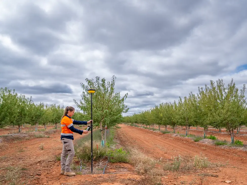
RTK (real time kinematic) GPS corrects each position as it is measured, from a few metres down to about 2 cm. We use it to survey the site before design, stake the design out during the build and record what went in the ground after it. The same team designs the block, so levels and changes go straight into the drawings.
Before design
A feature and contour survey of the site as it is.
During the build
Rows, pipelines, pump pads and structures staked out to the design.
After the build
As built data, so the drawings match what is in the ground.
What we do
What we cover.
Feature and contour surveys
A feature survey locates what is on the site, and a contour survey measures how the land falls. Together they make the topographic survey that the irrigation design, drainage and earthworks are built on.
- Levels and contours across the site
- Existing pipes, valves, pumps and structures
- Rows, tracks, channels, drains and power lines
- Delivered as CAD and IRRICAD files
Staking out
Once the design is set, we take it back to the paddock and stake it out with RTK GPS. Contractors then build to marks that match the drawings.
- Tree and vine rows
- Pipeline and main routes
- Pump pads, sheds and structures
- Set out for dams, drains and earthworks
Cut and fill and machine files
We turn the survey and the design into cut and fill volumes for quoting, and machine files that guide the operator to the design levels. On a current job, that is 2,500 ha of existing orchard surveyed to RTK grade with cut and fill machine files, and we are managing the laser bucket work that cuts the mid rows and headlands so water runs off and drains.
- Cut and fill volumes and maps
- Machine files for Trimble, T3rraCutta, Ezigrade and Topcon Civil
- Design surfaces for levelling and drainage
- Finished levels checked against the design
As built data
We survey what was actually installed, during and after the job, and update the drawings to match. When something needs finding, fixing or extending later, the drawings show where it is.
- Pipelines and valves as installed
- Pump stations and structures
- Changes made on site
- Records for maintenance and future upgrades
Survey and design in one team
Our surveyors and designers work in the same team. When something changes on site, we survey it and update the drawings, without waiting on another firm.
- One team from survey to as built
- Changes surveyed and drawn during the job
- No handover between firms
- Used to working on remote sites
What you get
Survey data that goes straight into design and the paddock.
- Contours and levels across the site
- Existing features located and drawn
- CAD and IRRICAD files
- Staking of rows, pipelines and structures
- Cut and fill volumes
- Machine files for your contractor's system
- As built drawings
- Drawings updated when the design changes
Questions
RTK surveys, answered.
What is a contour survey?
A contour survey measures ground levels across a site and joins points of the same height into contour lines, so you can see how the land falls. For irrigation, it shows which way water will run, how pressure will change across a block and where drainage is needed. We survey contours with RTK GPS to 2 cm.
What is the difference between a feature survey and a cadastral survey, and which do I need?
For irrigation design, earthworks and staking, you need a feature and contour survey, which maps what is on the ground and how high it sits. That is the survey we do, to RTK 2 cm. A cadastral survey marks legal property boundaries, and only a licensed cadastral surveyor can do one, so for boundaries that is who you need. We don't do boundary work, and we can work alongside your surveyor on the same property.
What does RTK mean in surveying?
RTK stands for real time kinematic. A base receiver at a known point, or a correction network, sends corrections to the receiver on the survey pole, which brings each position from a few metres down to about 2 cm as it is measured. We work to the same accuracy whether we are surveying the site, staking the design or recording the as built data.
What is a set out survey?
A set out survey, or staking out, marks the design on the ground so contractors build it in the right place and at the right level. We stake rows, pipeline routes, pump pads, sheds and earthworks with RTK GPS, straight from the design files. If something on site doesn't match the design, the same team can change the drawing and stake it again.
What is an as built survey?
An as built survey records what was actually built, where it is and at what level. Pipes and structures don't always go in exactly where the drawing shows, so the as built drawings become the record you use for repairs, maintenance and future upgrades. We collect as built data during and after installation and update the drawings to match.
How much does a contour survey cost?
It's priced on application, because every site is different. What drives the price: the area, how much detail and how many features need picking up, tree or crop cover, whether you also need staking, cut and fill or machine files, and travel. Send the property location and what the survey is for, and we'll come back with a scope and a price.
Related
Need a site surveyed or staked?
Send the property location, the area and what the survey is for. Nick, Matt or Aaron will call you back with a scope and a price.